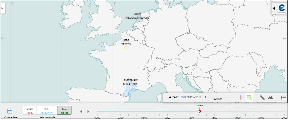
This is how the Interactive Map looks like when opened:
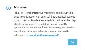
Note: a Disclaimer will appear the first time you launch the Map application:
The Interactive Map component is actually shared by multiple applications, allowing the controlled simultaneous display of three preprogrammed layers of information linked to separate NOP Portlets, as wel as "on demand" elements such as Flight Data or Airspaces.
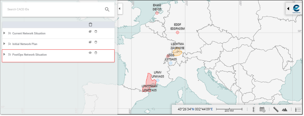
Depending on the originating link from which you access the Interactive Map, the corresponding layer will be set to visible (and all others set to invisible) as indicated by the ![]() and
and ![]() Visibility icons:
Visibility icons:
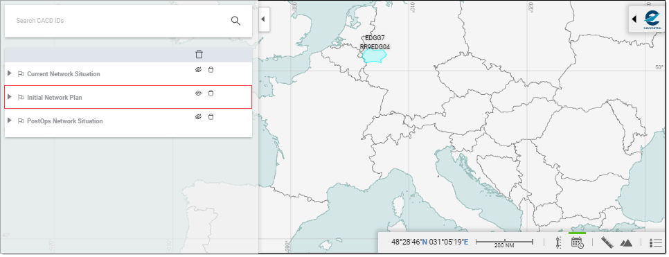
- and the PostOps Network Situation
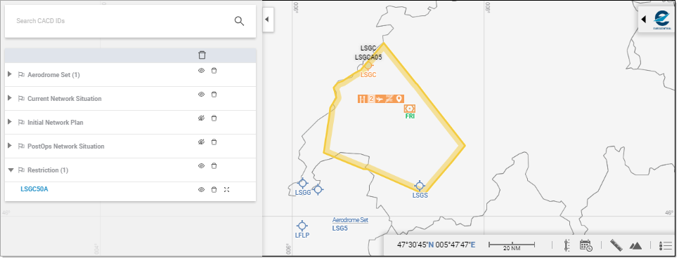
The Interactive Map further allows CACD Entities (airspaces, routes, points, aerodromes and aerodrome sets, restrictions...):
Map Layout
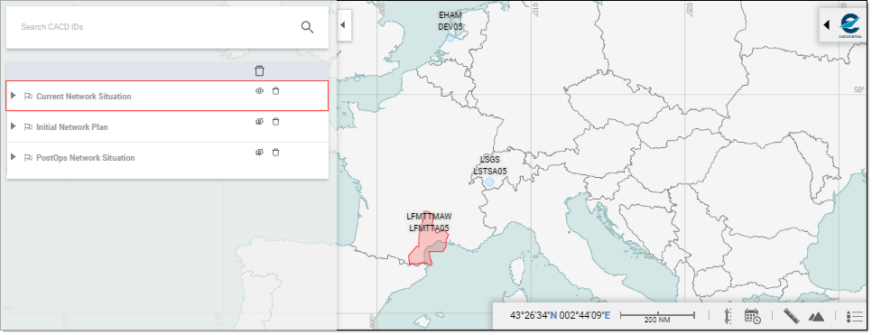
Map Dossier Tray
The Map Dossier Tray is the management component allowing you to perform all actions linked to the usage of Map Dossier.
Info Tray
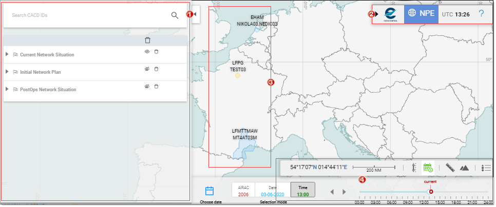
The Info Tray is located in the top right corner of the Map - click on the  Expand arrow to open it:
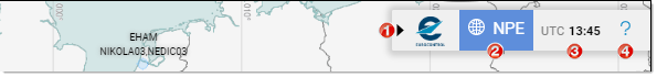
- Collapse arrow - to close the Info Tray
- Name of the Map - NPE in this case (stands for NOP Portal Extension)
- UTC Time
- Link to the Help package
Map Display
This is the main area, where the CACD entities are plotted. Several mouse actions are available to you to dictate how the content is to be displayed:
Zooming
Wheel controls
Roll up to zoom in - roll down to zoom out
Click controls
Left-Double-click to zoom in - Right-double-click to zoom out
About Zoom factor
(A zoom factor can be assimilated to a zoom "speed" - the higher the factor, the faster the zoom ...)
Zoom In / Out using a scale factor of 2 based on “+” / “-“ buttons of the navigation controller also with corresponding shortcuts on “+” / “-“ and numpad “+” / “-“ keyboard keys
+ mouse wheel scroll on mouse pointer using a scale factor of 1.5
+ CTRL-mouse wheel scroll on mouse pointer using a scale factor of 1.1
Panning
Click and drag the map in any direction to have map follow the mouse movements.
Controls
A series of controls and indications are grouped at the bottom of the Map display:

They comprise the following features:
 Coordinates: Indicates the coordinates of the point designated by the tip of the mouse pointer.
 Scale: Indicates the scale of the map as set by the current zoom factor (ranges from 2 NM to 2000 NM).
 LevelBand: Certain entities, like for instance a route, are defined for a given altitude or range. Make use of this tool to get to see the object as defined at the desired flight level.
 Timeline: Navigate back and forth in time and have the objects subject to specific timestamp and validities to visually reflect the changes in the course of the day, the week, the year, ...
 Measuring tool: Allows you to measure distances on the map.
 Vertical view: Displays the vertical definition for a given selected entity, along a user defined A-B line.
 Map legend: Provides compact access to the meaning of the various icons and symbols you may find on the Map.